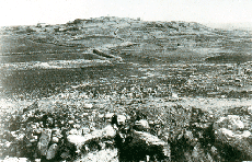
Tell Madaba in the 18th C. before intensive urban development. For information on the 2012 Archaeological Field School at Tell Madaba, please click HERE. Click below for archival footage of the first day of site orientation back in 1998!
|
Introduction |
The Tell Madaba Archaeological Project (TMAP) is a multidisciplinary research project investigating the early development of urbanism and urban institutions in the ancient Near East. It is part of an ongoing international research effort to create a regional database that will permit comprehensive analysis of the adaptive strategies and social institutions developed by human communities in the semi-arid Highlands of central Jordan, a geographical area distinguished by its climatic variability and environmental diversity. The site is situated within the modern city of Madaba, located 30 km southwest of Amman amidst the fertile plains of the Central Jordanian Plateau, forming a continuous urban tradition that can be traced back in time at least 5,000 years. The ancient settlement consists of a large low-lying tell and acropolis (approximately 16 ha in area at the base and 9 ha at the summit). Surrounding the tell, but primarily to the north, are the remains of the classical town, represented most notably by the churches and mosaic pavements which have brought Madaba such fame. Documentary sources, including the Bible, the Mesha Inscription, and a wealth of later classical sources, attest to Madaba's prominent role in the long and eventful history of this region. TMAP has been funded by research grants from the Social Sciences and Humanities Research Council of Canada (SSHRCC), the National Geographic Society, the American Schools of Oriental Research, and the Connaught Fund of the University of Toronto. **website last updated April 3, 2012 |