

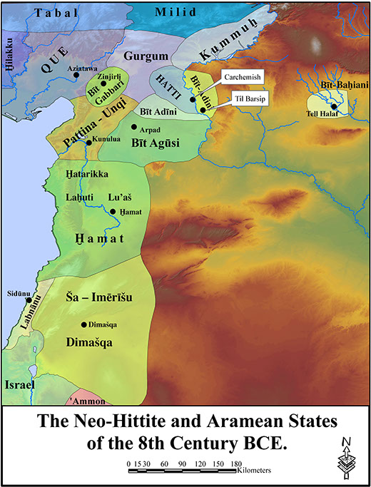
During the historically well-documented Iron II period (ca. 900-700 BCE), North Wetern Syria was characterized by a patchwork of these diminutive city-states, sometimes referred to as Neo-Hittite, Aramaean, or Syro-Hittite, depending on which language was most prevalent in a given kingdom’s indigenous historical records. Contemporary Neo-Assyrian royal inscriptions paint a picture of the extraordinary wealth of these kingdoms, foremost of which was the Kingdom of Patina.
The number of historical sources increases significantly during the 9th through 8th centuries, due largely to increasing Neo-Assyrian interest in the region. The earliest Neo-Assyrian references derive from Ashurnasirpal II, who mentions receiving tribute from Lubarna, King of Patina; Ashurnasirpal also names Lubarna's royal city as Kunulua. The reference occurs in the course of a military campaign to northwest Syria, and includes a detailed itinerary that clearly situates Patina in the Amuq Valley, and its capital Kunulua adjacent to the Orontes River, leaving Tell Tayinat as the only viable candidate. This identification has now been confirmed by epigraphic discoveries at the site itself. Over the course of the next century and a half, Patina participated in a series of Syro-Anatolian political coalitions against the Assyrians, before succumbing in 738 BCE to the empire builder Tiglath-pileser III, who annexed the kingdom into an expanding Assyrian Empire as the province of Kullani . Many of the objects described in these Neo-Assyrian royal annuals, especially the bronze horse trappings and ivory furniture decorations listed in their tribute lists, have been found in Assyrian capital, as well as in prominent Aegean settlements, such as Samos and Eretria. The site of al-Mina, located on the Mediterranean coast 40 km west of inland Tayinat, was clearly Patina’s port. This rich historical record and widely distributed artifact inventory thus attest to Patina’s elevated importance as a major center of specialized craft production, and the North Orontes Valley as a strategic interregional intersection during the Iron Age.
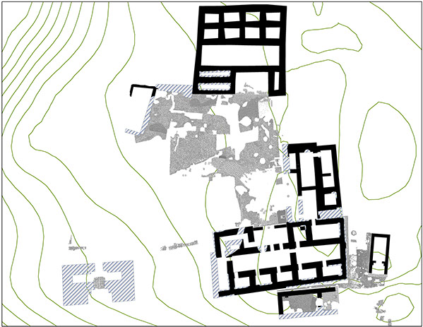
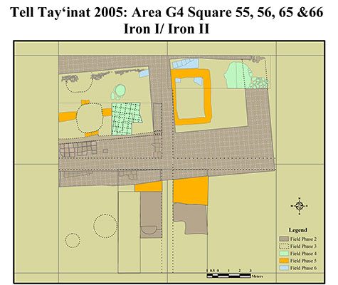
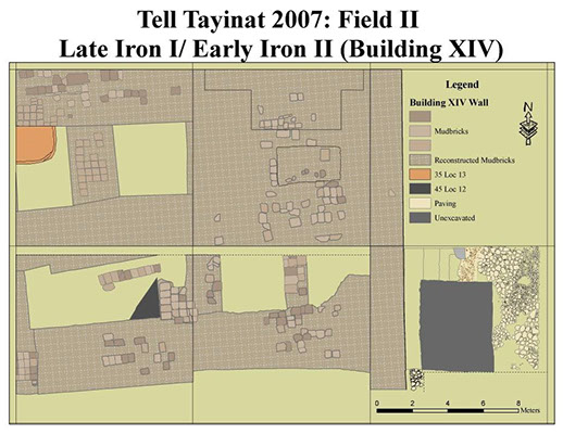
Iron II levels have been revealed primarily in Fields 1 and 2 where the foundations of Temple II and earlier Iron II roadway were excavated in Field 1. In Field 2, the foundations of the enigmatic Building XIV was excavated, revealing further additions to the expansive structure, than had been identified by the Chicago excavations.