


After a 70 year hiatus, the Tayinat Archaeological Project (TAP) was launched in 1999 as part of the Amuq Valley Regional Project (AVRP), which had been systematically documenting the archaeology of the Amuq Plain since 1995. TAP was conceived within the interdisciplinary context of the AVRP as part of a long-term regional research effort investigating the historical development of urban institutions and the rise of early state-ordered societies. While previous research has documented the introduction of urban institutions, and the development of specialized craft industries and extensive inter-regional trade networks, to examine these developments on a truly regional scale, local cultural sequences must be well-documented and a precise chronological framework in place; criteria that are lacking for much of the eastern Mediterranean region.
TAP was initiated to address this problem by returning to the cultural sequence defined during the pioneering work of the Syrian-Hittite Expedition in the 1930s in the strategically important Amuq Plain region of southeastern Turkey. The primary aim is to assemble archaeological data from the presumed urban center of a succession of prominent, historically-attested Bronze and Iron Age polities for comparison with existing data sets from comparable contexts at rural sites in the region. This explicitly regional approach is designed to facilitate multiple levels of analysis, and to produce the multivariate data needed to engage in more systematic investigations of the complex social, economic and political institutions developed by the first urban communities to emerge in this part of the world. Since 1999, TAP has successfully documented the remarkably well-preserved Iron Age settlement at Tayinat, when the site emerged as the capital of the nascent 'Land of Palistin' and its successor the Syro-Hittite Kingdom of Patina.
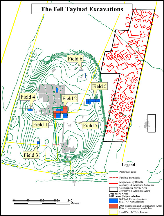
To date, the Toronto expedition has opened wide horizontal exposures of close to 3000m2 dated to the Early Bronze IV, the Iron I, II, and III, examining all periods of occupation at the site.
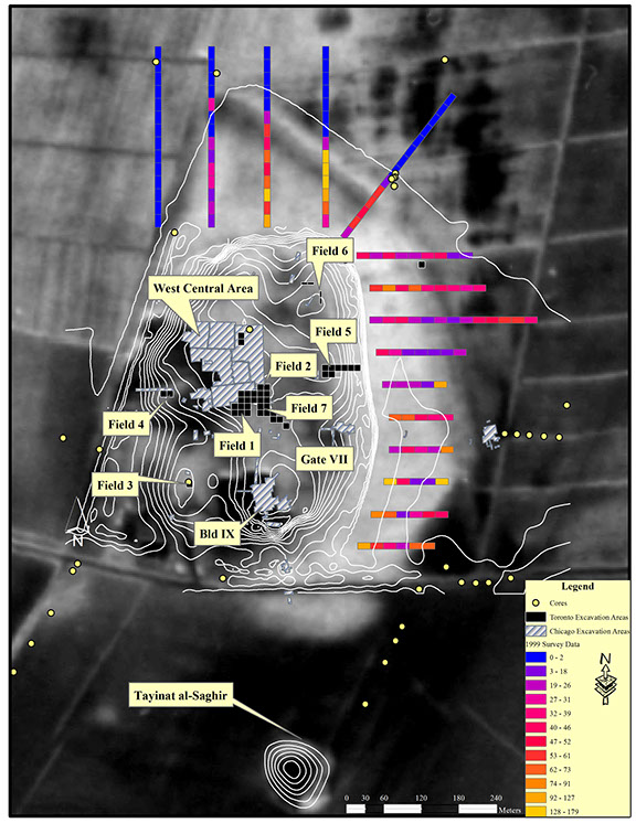
Additionally, we have undertaken geomorphological and geophysical investigations around the tell in an effort to understand the both the local geomorphological and settlement history of the site.
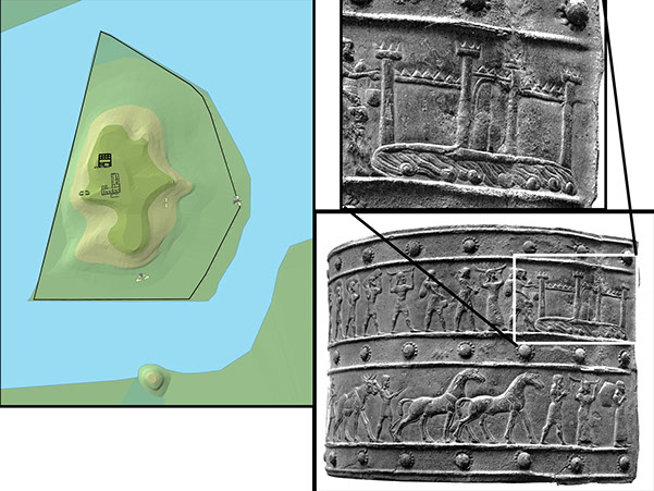
Coring around the site has revealed that in the Iron Age, the settlement was probably surrounded by a lake and marshy environment. Such a reconstruction fits well with contemporary Neo-Assyrian records, such as the images and inscriptions from the Balawat Gates in northern Iraq, which appear to depict a settlement of the kingdom of 'Unqi, surrounded by water.
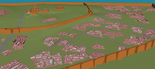
Geophysical work reveals a densely packed lower-town settlement containing numerous house compounds, similar to those excavated at the contemporary site of Çatal Höyük (in the Amuq) in the 1930's by the Chicago expedition.