Click below to see archival footage of excavations at Tell Madaba in 2001.
INTRODUCTION:
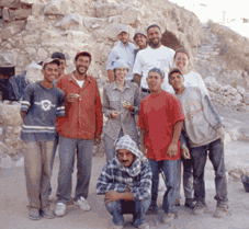
In light of the extensive excavations we have conducted over the past few years (1998-2000), rather than conduct further excavations this year, the 2001 field season of the Tell Madaba Archaeological Project (TMAP) was directed toward the consolidation and restoration of the Late Byzantine and Early Islamic structures preserved along the western slope of the acropolis in Madaba. The 2001 season, therefore, saw the continuation of architectural stabilization efforts in Field C begun in 1999 and 2000, and the initiation of a program to restore the mosaic pavements removed from the site in the early 1980s. In addition, as part of our ongoing commitment to document the visible archaeological remains at sites in the Madaba region that face expanding modern development, mapping and surface surveys begun in 2000 at Libb, Khirbat al-Mukhayyat and Masuh were completed during the 2001 season. The 2001 season was conducted between June 1 and July 27, with the author continuing as overall project director. The Field C operations were directed by Debra Foran, with the assistance of Fiona Haughey (Illustrator) and Caroline Puzinas. The survey team consisted of Dayle Elder, Jonathan Ferguson and Andrew Graham. Ibrahim Zaben served as the Department of Antiquities representative during the month of June, while Zakariya al-Quda was the Department representative in July.
FIELD C CONSOLIDATION AND RESTORATION (Debra Foran):
The primary goals in Field C for the 2001 field season were to:
Clean the area in the northern corner of Field C, to the north of the excavated portion.
Continue the consolidation and restoration of the Late Byzantine/Early Islamic architecture.
Initiate a program to restore the mosaic pavements in Field C, including pavements removed from the site in the early 1980s.
To date, the architectural remains uncovered in Field C consist of a series of rooms, several paved with mosaic floors, belonging to a single large complex, possibly a private residence. Some of the architecture was repaired and reconstructed during the 1999 and 2000 field seasons.
We began cleaning the area to the west of the Late Ottoman house on the northern edge of the site, so that a wall and terraces could be constructed as a northern border to the site later in the season. However, it became clear after the first week that most of the soil on the northern edge of Field C would have to be removed, not only for presentation purposes, but also for safety reasons. There were several large boulders protruding from the soil that were in danger of falling. Removal of this soil also permitted greater exposure of the exterior face of the pre-classical fortification wall.
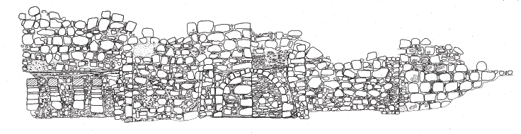
Thus we began the removal of the soil north of Square 5L22T4 and west of the city wall. The top portion, measuring approximately 1.5 m thick, contained modern debris, several ash pockets, and some Late Ottoman remains, represented by the fragments of several tobacco pipes. A deposit of reddish brown soil was located under this modern debris. A limited portion of this layer was removed to determine the date of its deposition, which appeared to have occurred sometime during the Early Islamic period, as the soil contained only Late Byzantine and Early Islamic pottery. There were several large stones in this layer, some of which had been carefully cut (image right). The provenience of these stones is as yet uncertain. They may have come from the fortification wall, some other structure on the upper tell, or from a structure that remains buried below the reddish brown soil.
The soil removal in the northern section of Field C also resulted in the uncovering of a large modern wall that forms part of the northern border of the site. A foundation trench extended approximately 1 m south from the wall. The wall appeared to have been founded on an earlier structure, but this has yet to be determined. In order to stabilize and solidify the wall, cement was inserted between the stones of the wall, and a layer of mortar applied over the cement.
The northern extension of the fortification wall was also exposed during soil removal in Field C. In addition, the top of a wall oriented in an east-west line from the city wall was uncovered (image left). It is plastered on both sides, and it may represent the northern wall of the Late Byzantine/Early Islamic building. The lower courses of this wall may form the foundation for the modern wall that borders the northern property line of the West Acropolis area.
The second objective for the 2001 field season in Field C was to clean the lower portion of the northern edge of Field C, to the north of the flagstone floor excavated during the 2000 season. The modern field walls that marked property lines were removed in order to construct a more stable wall line along the northern border of the site. During this operation, the western extension of the flagstone floor and the wall that delineates its northern border were uncovered (image right). The water channel that runs under the step in front of this wall extends further west. A carved stone threshold was discovered in this northern wall, and opens northward into the property located adjacent to the site. The flagstone floor appears to represent part of a large courtyard located within the Late Byzantine/Early Islamic building complex.
In summary, the cleaning operations of the 2001 field season have allowed us to determine that the Field C building is considerably better preserved than originally thought. Now that the modern debris has been removed, excavations should be conducted to document fully what remains of this large and impressive complex, so that it can be consolidated and restored appropriately, and presented to the public. In anticipation of this next phase of fieldwork, a program to restore the mosaic pavements in Field C was also initiated during the 2001 field season. Arrangements were made for the Italian restorer Franco Sciorilli to commence preparation of the mosaic pavement removed in 1980 from the vaulted structure in Field C, and now stored in the MadabaMuseum. This work (planned for August, 2001) will involve removal of the concrete bedding the mosaic is currently adhered to in preparation for its return to the site during our next field season.
In conjunction with the Field C consolidation efforts, further documentation of the monumental fortification wall also was completed during the 2001 season. This included creation of a detailed top plan of the wall , and a plan of its vertical profile (see below). Further analysis was also carried out on the phasing of the extant architecture in Field B, to the east of the fortification wall . The results of this analysis will be incorporated in a more thorough preliminary report of the 1998-2000 field seasons that will be submitted shortly for publication in ADAJ.
TMAP REGIONAL SURVEY:
As part of the broader TMAP research objective to develop a regional database, and in keeping with our commitment to document the visible archaeological remains at sites in the Madaba region that face expanding modern development, intensive mapping and surface collection efforts were initiated during the 2000 field season at a series of hinterland sites to the west and south of Madaba. This initiative was continued during the 2001 field season, with the primary focus aimed at completing mapping and surface surveys begun in 2000 at Libb, Khirbat al-Mukhayyat and Masuh.
LIBB SURFACE SURVEY (Dayle Elder):
INTRODUCTION
Libb is situated on a large oblong khirbat oriented on a southwest-northeast axis and located approximately 13 kilometers south of the modern town of Madaba. The population of the modern town is about 10,000. The site appears to be positioned atop two terraces. The Wadi Libb is located to the north and east of the site. Numerous cisterns are located within the site boundaries, which are used for the collection of water in winter, during the rainy season. A local resident informed the field crew that the water collected within the cisterns, along the lower portion of the site, is often used to saturate the crop fields located at the bottom of the slope. Surrounded by low sloping hills, the site sits in a fertile valley located on the southwest edge of the Madaba Plain, virtually in a bowl-shaped landform. At the time of the survey, olive trees, fig trees, tunas, and grapes were observed growing in the fields that surround the site. Fallow fields were used for grain crops. Large exposures of limestone bedrock are also present along the slope of the khirbat. The khirbat contains a combination of modern houses, which make up the villageof Libb, and archaeological ruins consisting of Ottoman houses and exposed wall lines. As a result of bulldozer activity and non-archaeological excavations within the site, deep cultural deposits have been exposed. A number of different time periods were represented by the pottery observed within these cuts. Libb sits along the modern route commonly known as the King’s Highway, and follows the Roman Via Nova Traiana, often believed to have been based on the older biblical King's Highway. Libb may have benefited greatly from the fertility of its surroundings, and it might have also been used as an entrepot located along these ancient trade and travel routes. Much of the site has been disturbed or completely destroyed due to modern construction. All of the Ottoman houses have suffered severe damage in one form or another, and many have been destroyed completely and are no longer visible on the surface.
THE 2000 SURVEY
A brief archaeological survey of Libb was conducted between August 5-22, 2000. The field crew consisted of Dayle A. Elder and Timothy B. Griffith, with Reem Shqoor as Department representative. The objectives of the survey were to:
Assess the archaeological integrity of the site.
Investigate the potential for future excavations, attempting to ascertain the extent of previous phases of occupation.
Document the destruction of archaeological materials due to the construction currently taking place at the site.
The 2000 survey focused on mapping the location of all traditional Ottoman houses and exposed archaeological remains. In addition, a mechanically generated random surface collection was initiated to assess the occupational periods represented. Due to the location of the modern village and time restraints, surface collection was restricted to the acropolis of the khirbat. This location was chosen due to the lack of modern houses, which are located along the slopes around the upper town. Only four Ottoman houses were observed along the lower portions of the slope of the upper khirbat. No previous excavations have been reported for the site, and only brief descriptions of the site exist in a few references. In addition, the entire site was walked and visually inspected by the field crew in order to assess its overall condition.
SURVEY METHODLOGY
The survey involved detailed mapping (using a total station, with the data downloaded into AutoCAD and Arcview GIS), and surface collection from mechanically generated randomly placed 10 m sq collection units. All identified Late Ottoman houses, cisterns, caves, and exposed wall lines were mapped. The first stage of this survey involved locating and mapping all standing Ottoman houses, cisterns, caves, and exposed wall lines. This was accomplished with the aid of the total station. The second stage of the survey involved collection of archaeological materials from 10 x 10 m sq randomly placed over the site. This phase, begun during the 2000 field season, was completed during the 2001 season.
PRELIMINARY RESULTS OF 2000 AND 2001 SURVEYS
The 2000 surveying effort resulted in a detailed topographic map of Libb, with all identifiable premodern houses also included on the site plan. The surface survey resulted in the collection of 3,705 sherds from 49 survey squares. The sherds were washed, read, and registered in Madaba. The diagnostics were separated and will be shipped to Torontofor further study. The major periods represented in the current ceramic corpus from Libb are Iron Age, Roman, Byzantine, Umayyad and Mamluk. The sherd collection revealed approximately 131 Iron Age, 282 Roman-Byzantine, 105 Umayyad, and 391 Mamluk diagnostics. One possible Abbasid, and two Nabataean sherds were also identified. Ottoman period ceramics were also recognized. The volume of Mamluk pottery was extensive, and suggests the existence of a significant settlement at the site during this period. The 2000 survey was brief and isolated to only the upper segment of the site. However, it provided much needed information concerning the archaeological record preserved at Libb. A total of 22 Ottoman houses, 20 cisterns, 11 caves, and 74 wall lines were located and mapped. A total of 49 units were systematically inspected, and all visible cultural material was collected. The materials collected included pottery, lithic debris, and a variety of fragmentary basalt ground stone tools.
The 2001 field season saw a continuation of the surface survey at Libb. Work recommenced on June 8, 2001, and continued intermittently until July 25. The first task was to locate the benchmarks and reference points from the previous season. Due to the construction of a new house, the main benchmark utilized in 2000 was unavailable. Two other reference points had been destroyed by the bulldozing of a new road to the west of the town water tower. However, reference point TS4 was retrieved, and the site grid was re-established from this point. Further topographic mapping of the western side of the site was completed on June 8, 2001, and sampling of collection units began on June 12. Collection units were located with a hand held Global Positioning System (GPS) using reference points re-established from the 2000 season. Work in 2001 focused on the slopes and immediate surroundings of the site in order to delineate the extent of occupation during specific cultural periods, and to identify any installations not noticed or mapped in 2000. A total of 108 squares were collected, while 139 squares were unable to be collected due to the presence of modern structures. In total, 157 squares have been collected from all areas of the site. The heaviest concentrations of artifacts collected this year were from the upper eastern and northeastern slopes, while there was a noticeable decrease on the lower reaches of the site. A total of 5,342 sherds were collected from the 108 squares surveyed this year. Preliminary readings of the ceramic evidence indicates that Libb was first settled in the Iron Age, likely the Iron Age II, although a possible Collared Rim pithos sherd may indicate an earlier Iron Age I settlement phase. Nearly every subsequent cultural period has been represented in the ceramics collected at Libb. While most periods are represented in the ceramics, Iron Age (2023 sherds), Roman-Byzantine (2495 sherds) and Mamluk (50 sherds) pottery comprise the bulk of the sample.
OFF-SITE TRANSECTS
On July 25, a series of transects were walked in the fields directly north of the site. In order to better define the extent of ancient settlement, and locate possible installations, thirty 200 m north-south transects were walked in the fields to the north of the site. Surface pottery was collected every 10 m within a 3m radius. A GPS unit was used to locate the start and end points of every 5th transect, in order to position each transect accurately on the site map. The north side was selected for reconnaissance because it offered the widest continuous expanse of unoccupied land extending from the base of the site, and also included a section of the Wadi Libb. The off-transects indicated only a sparse sherd presence in these agricultural fields. The bulk of the sherds dated to the Roman-Byzantine era, with a small number from the Iron Age. There was a marked increase in Byzantine sherds in the vicinity of a ca. 75m. long wall to the north of the Wadi Libb. This wall seems to run perpendicular to another wall to the west that is now part of a modern boundary fence south of the Wadi Libb. An eastern corner to the wall was not identified during the course of this investigation. Three dams were discovered in the Wadi Libb. The first, Dam 1, was located in the south bank of the Wadi Libb, and measured ca. 1.5m. in length, and was preserved 2 courses high. This dam was also incorporated into a modern boundary wall. Dam 2 was constructed of rough-hewn fieldstones, and was preserved ca. 2 courses high, 1 row wide and extended northward 4.60 m from the side of the wadi. The dam ran due north another 8m into the field, and appears to connect to a possible cistern. The cistern measured ca. 3m in diameter, and was built of stones between 25-50 cm in width. Pottery collected from around the dam dated to the Roman-Byzantine period. Dam 3 was discovered to the east of Dam 2, just west of the modern King's Highway. It emerged 5.50 m from the north side of the wadi. It was preserved to three courses high, and was apparently 1 row in width. This dam wall ran for another 14 m almost due north into the fields north of the site.
SUMMARY OBSERVATIONS
The survey of Libb indicates that the site likely was inhabited almost continually from the Iron Age to the present day. Wall lines located at the base of the north side of the site may have been part of a reservoir fed by the seasonal wadi. The surrounding fields were likely reserved for agricultural cultivation throughout the occupation of the site. Installations for the production of olive or wine were probably maintained in the exposed bedrock hills that surround Libb. Questions regarding the date and function of a series of "ring roads" that encircle the site were resolved during the 2001 survey season. On the southeast side of the site, a modern road has cut a clear cultural deposit over two meters in depth. This deposit continues under the road. A quantity of Iron Age sherds, including painted Moabite Ware, was collected from two squares located on the lower road cut. Therefore it is likely that these ring roads, once thought to have been ancient terraces reused as modern roads, are entirely of modern construction. Pottery collected in the 2001 season does not significantly differ from that of the previous season. The dominant periods identified so far from Libb remain the Iron Age, Roman-Byzantine, and Mamluk periods. While Iron Age and Roman-Byzantine sites are well known in the Madaba Plain, Mamluk settlements have not been as well documented. Excavations at Libb, therefore, with its extensive remains from this period, would add important information to the history of this poorly understood period. Given the extensive archaeological history documented by the survey at Libb, it is recommended that measures be taken to minimize the loss of this important archaeological record. The development of the summit of the site seriously threatens the archaeological remains preserved there. While such efforts likely would not take the form of full-scale excavations, due to the modern buildings and standing Ottoman houses, a series of test units, however, could recover important information about the archaeology of small settlements in the region, particularly during periods of limited sedentary activity. Consequently, it is recommended that limited scale excavations take place at Libb, especially before more of the site is irrevocably lost to modern development.
The site of Khirbet al-Mukhayyat (ancient Nebo) lies some 9 km northwest of Madaba, on the southeastern spur of the Nebo ridge. Situated on a steep limestone promontory, Mukhayyat commands an impressive view overlooking the Dead Sea and Jordan valley to the west. Most famous for its Byzantine mosaics and ecclesiastical architecture, Mukhayyat also boasts an extensive array of tombs, caves, cisterns, various agricultural installations and a well-preserved fortification system. Despite the abundance of this material, previous archaeological research at Mukhayyat has generally concentrated its efforts towards the examination and preservation of the Byzantine occupation at the site. While such research has been a significant contribution to the understanding of Byzantine culture in this region, the exclusion of earlier material has left a gap in our understanding of the occupational sequence at Mukhayyat. Modern exploration of the site began in 1863 with a brief visit by Félicien De Saulcy, who is generally credited with being the first to record the name, Khirbet al-Mukhayyat. In the summer of 1901, Alois Musil was the first to explore Mukhayyat systematically, identifying the Churches of Lot, Procopius, Amos and Kasiseus. In addition he also created the first topographic plan of the site. Nelson Glueck visited Mukhayyat in 1932, comparing the well-preserved fortifications with those of the al-Mashhad fortress near ‘Ain Musa and el-Medeiyineh to the south. He is also to be credited with the first identification of the rock cut towards the southern end of the site as a moat. Much of our current understanding of Mukhayyat comes from the efforts of the Studium Biblicum Franciscanum. Systematic explorations by the Franciscan’s began in 1933 with Brother Jerome Mihaic’s work uncovering the mosaics in the Chapel of the Priest John on the eastern slope of the tell, and in the Church of Saint George on the acropolis. In the 1960s an expedition led by J. Ripamonti conducted excavations at Rujm al-Mukhayyat, as well as a survey of the area that produced two Iron Age tombs, both of which were subsequently excavated by Saller in 1965. Work continued in the early 1970’s at Mukhayyat under the direction of Fr. Piccirillo. It was during this time that a comprehensive preservation and conservation program began that would involve all of the excavated mosaics and related architecture at the site. In the late 1980s and early 1990s this work continued with detailed excavations on the acropolis and surrounding area, resulting in the primary data that has afforded our current understanding of the occupational sequence at Mukhayyat.
2001 SURVEY OBJECTIVES
The 2001 survey follows on the topographic survey completed in 2000. The principal goal of the 2001 season was to randomly recover 20% of the extant surface remains (lithics, pottery, etc.) in order to produce a density and distribution profile of the occupational history of the site. A second objective was to continue observation and documentation of extant architectural remains at Mukhayyat, the purpose of which is to provide additional data in support the analysis of the cultural material collected.
PRELIMINARY RESULTS
A survey universe was created over a DEM (Digital Elevation Model) of Mukhayyat, consisting of a 10 x 10m2 potential collection grid across the primary occupational zones of the site. A total of 211(out of a possible 1055) collection units were randomly generated and plotted on the DEM. All surface collection was completed by July 4. Using a combination of Total Station and GPS technology each survey unit was located and marked for collection with four painted survey stakes. Once located, all surface cultural remains (lithics, pottery, etc.) were collected using a standard recovery time of 15 person minutes per unit. All material was bagged separately and labeled with the appropriate collection unit number. At the end of each collection day, all material was transported off-site back to Madaba for processing and registration. Off-site processing and registration consisted of sample preparation (washing and drying), sample distribution (separation of cultural material into appropriate chronological sequence), and sample selection. For purposes of analysis, ceramic body sherds considered non-diagnostic, were separated out from the overall sample for return to site. The only material retained for further analysis consisted of diagnostic sherd material, lithics, tabun fragments, and basalt samples. The total sample collected consisted of 23,210 ceramic sherds, of which only 2,333 were considered diagnostic, leaving 20,951 sherds to be returned to site (done on July 27th, 2001). In addition to the diagnostic ceramic material, 210 lithics, 33 basalt samples and 70 tabun fragments were also retained for further analysis.
SUMMARY OBSERVATIONS
While no final conclusions can be made without more in-depth analysis, some preliminary observations of the cultural material recovered are possible. It is clear from the distribution of ceramics by period type that Mukhayyat shows a significant density of ceramics dating to the Byzantine and Iron Age periods across the entire survey universe. While the majority of pottery recovered is attributable to the Byzantine period (16,096 sherds), significant quantities of Iron Age ceramics (7,074) have been identified. While other periods were represented in the recovered material, their sherd counts demonstrated only ephemeral, sporadic occupation generally restricted towards the northern end of the site. It is expected that future analysis will incorporate the topographic information contained within the GIS alongside the recovered material culture in order to suggest more tightly defined occupational zones across the site during the Byzantine and Iron Age periods. More traditional ceramic analysis will be performed on the diagnostic material with the goal of inserting the recovered ceramics into the wider morphological sequence of the region. Finally, petrographic and chemical analysis on selected diagnostic material may provide additional information with regard to ceramic production technology, as well as points of contact between other sites within the region. Ultimately it is anticipated that the results of these analyses will support further fieldwork and excavation at Mukhayyat as part of a larger research effort to continue to fully document and discover the history and importance of one of Jordan's most spectacular cultural resources.
MASUH TOPOGRAPHIC SURVEY (Jonathan Ferguson):
INTRODUCTION
The site of Masuh is located approximately 10 km north of Madaba, 3 km east of Hesban by road. Masuh is also known in the archaeological literature (see the bibliography below) as: Masouh, Khurbet Masuh (or Hirbet Masuh), Massuh (or El-Massuh) and Tell Masuh. The site includes a necropolis (with olive presses and water facilities) to the southwest, two churches, a temple and numerous other architectural remains. The main area of the site lies on a hill rising to the north of the road from Hesban, and is characterized by a large number of crater-like pits, many of which have cisterns or subterranean arch-roofed structures at their bottoms. The length of occupation at Masuh extends from the Iron II or Persian period until the present day, although probably not continuously. C. R. Conder, who visited the site in 1881, wrote the earliest archaeological assessment of Masuh. Other archaeologists visited the site, but excavations did not begin until 1970, under Bastiaan Van Elderen, who studied a church (referred to by this study as the “East Church”) and its mosaics. In 1982, Fr. Michele Piccirillo began excavations at the same church, removing part of the upper mosaic floor (now in the Madaba Archaeological Park) and exposing the lower mosaic floor. R. D. Ibach also studied the site, as part of the Hesban Survey in 1973, collecting 315 sherds. This surface collection included Iron II/Persian, Late Roman, Byzantine, Umayyad, Ayyubid/Mamluk/Otttoman and modern sherds. In the summer of 2000, Hazem Jaser, Director of the Madaba office of the Department of Antiquities, excavated another church (here the "North Church"). Hazem Jaser kindly provided a copy of the plan of this church, as yet unpublished, for this study.
AIMS OF THE TOPOGRAPHIC SURVEY
Although the two churches have been thoroughly studied and the site has been generally described, no overall site plan has been produced for Masuh. The primary aim of the 2001 Masuh topographic survey was to produce an accurate topographic map of the central settlement area of Masuh, integrating total station data with a geographic information system. A secondary aim of the survey was to form a small general surface collection of ceramics and other artifacts to identify the periods of occupation at the site.
SUMMARY OF WORK
First, the survey team briefly visited Masuh, to ascertain the size and nature of the site. The necropolis, churches, and temple were located, and a number of topographic and architectural features were noted. A pre-existing stake on the highest hill was designated as MTS 01 (Masuh total station point), and its UTM coordinates and elevation were determined with a GPS receiver. Another stake to magnetic north was designated MTS 02, and was used to orient the total station. Other pre-existing stakes were located and assigned numbers MTS 03 to MTS 06, while a new stake was positioned on the second highest hill (southwest of MTS 01) as MTS 07. Topographic mapping commenced from MTS 01, with the areas to the north, northwest, west and southwest mapped. In all, 419 points were taken with the total station in this initial mapping phase. Topographic mapping continued from MTS 01, with 528 points taken with the total station, to the north, north-east, east and south, beginning from the extent of the mapping from Day 2. A small number of sherds were selected as part of the general surface collection. Setting up the total station on MTS 07, topographic mapping was continued in the southeastern area of the site, with a total of 532 points taken. Particular attention was given to the East Church (i.e., the church excavated by Van Elderen and Piccirillo) so that a plan of the church could be accurately overlaid on the topographic map. To the northwest of the church, two inscribed stones were noted, which do not appear to have been previously published. One is a fragmentary Latin or Greek inscription, which now only reads “MA”. The other has a Christian cross which is different from the one published by Piccirillo (1983, photo 37). Because the floor plan of the temple could not be discerned, the area of the columns, including the inscribed one (see Piccirillo 1983, photos 2-3), was delimited with a polygon. As a southern limit to the survey, a line of points was taken southward from the temple and along the road. Again, a small number of sherds were taken for the general surface collection A new total station point, MTS 08, was established in the southwestern part of the site, above the slope down to the modern village. Over the course of the day, 570 points were taken with the total station, starting at the temple and moving westwards, to the southwestern extent of the site’s slope. Points were then taken in the area of the modern village, extending down the southern slope to the present-day road. Sherds were collected for the general surface collection, as well as two tesserae that were found away from the two known churches. Two new datum points, MTS 09 on the western side of the site and MTS 10 to the south, were established to complete the topographic mapping of the site. On this day, 773 points were taken with the total station on the eastern side of the site, then along an arc north and west towards the North Church. Detailed topographic points were taken in this area to correctly show the surrounding relief of the church. The survey area extended westward to a ditch and south to the limits of the previous day. Further points were then taken from MTS 10 to complete the southern slope of the site down to the modern road. Geo-referencing points were taken in both churches in order to be able to overlay their plans on the topographic map. Geo-referencing points and photographs were also taken for a number of items of interest: the “MA” inscription; the Byzantine cross; an inscription reading “A”; an Arabic inscription; the inscribed column drum in the temple; an isolated column drum on the western side of the site; and a large vaulted cistern. The cistern, located on the west of the site near the dirt road, appears to have had its entrance cleared recently. Steps carved into the bedrock lead down to the chamber, which is rock-cut, but is supported on the south (right) by a stone half-vault. Three plugged cistern holes are visible in its ceiling, one of which appears to have a sealing-stone in place. A few sherds and fragments of glass and of an Ottoman pipe (both from the area of the North Church) were taken for the general surface collection.
MAPPING WITH GIS
At the close of each mapping day, the data were downloaded from the total station into a laptop computer. These data were then imported into the ArcView GIS (Geographic Information System), updating the previous data set. Using ArcView, a digital elevation model and a topographic contour map have been created (see figure 9). Plans of the two churches were scanned, then geo-referenced and traced in AutoCAD, before being imported into ArcView to create composite views.
SUMMARY OBSERVATIONS
A total of 2,822 topographic points were taken in the settlement area of Masuh (i.e. excluding the necropolis), to the north of the modern road from Hesban. These were imported into ArcView GIS to produce an accurate topographic map of the site, over which digitized plans of the excavated churches were superimposed. A general surface collection of sherds and other objects was collected for further research. The total collection included 60 sherds, 2 lithics, 2 tesserae, as well as fragments of a steatite bowl, an Ottoman pipe, and a piece of glass. Of these, a study collection was assembled which includes all but 30 of the sherds and the tesserae, which were discarded. The items in the study collection will be studied and drawn at a later date, in order to complete a preliminary assessment of the occupational history of Masuh and compare these results with those of the Hesban Survey. Digital and print photographs were taken of some of the more important architectural remains and other features such as the inscriptions. These points also were geo-referenced with the total station. The resulting photographic archive will help to more fully document the site. Conclusions from the topographic and ceramic studies of Masuh will be used to determine what activities may be feasible in future research seasons. It is hoped that the site map produced by the 2001 Masuh topographic survey will help both to document the site, and serve as an aid for future researchers. The results of modern looting at the site for stone and artifacts was observed during the mapping process, and increases the need for enhanced cultural resource management at this important Late Antique and Mediaeval site.
ACKNOWLEDGEMENTS:
Funding for the 2001 field season was provided by a research grant from the Social Science and Humanities Research Council of Canada. The excavations were conducted in collaboration with the Department of Antiquities of Jordan, which provided guidance and access to field equipment. The season’s results would not have been possible without the dedicated help of Dr. Fawwaz al-Khraysheh, Director General of the Department of Antiquities, and Hazem Jaser, Director of the Department of Antiquities Office in Madaba. I wish also to thank the Mayor of Madaba, who unhesitatingly offered his assistance and freely made available the resources of the Municipality of Madaba, including use of an end loader and several dump trucks.
 To date, the architectural remains uncovered in Field C consist of a series of rooms, several paved with mosaic floors, belonging to a single large complex, possibly a private residence. Some of the architecture was repaired and reconstructed during the 1999 and 2000 field seasons.
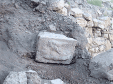 Thus we began the removal of the soil north of Square 5L22T4 and west of the city wall. The top portion, measuring approximately 1.5 m thick, contained modern debris, several ash pockets, and some Late Ottoman remains, represented by the fragments of several tobacco pipes. A deposit of reddish brown soil was located under this modern debris. A limited portion of this layer was removed to determine the date of its deposition, which appeared to have occurred sometime during the Early Islamic period, as the soil contained only Late Byzantine and Early Islamic pottery. There were several large stones in this layer, some of which had been carefully cut (image right). The provenience of these stones is as yet uncertain. They may have come from the fortification wall, some other structure on the upper tell, or from a structure that remains buried below the reddish brown soil.
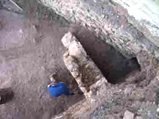 The northern extension of the fortification wall was also exposed during soil removal in Field C. In addition, the top of a wall oriented in an east-west line from the city wall was uncovered (image left). It is plastered on both sides, and it may represent the northern wall of the Late Byzantine/Early Islamic building. The lower courses of this wall may form the foundation for the modern wall that borders the northern property line of the West Acropolis area.
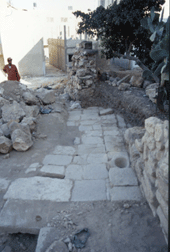
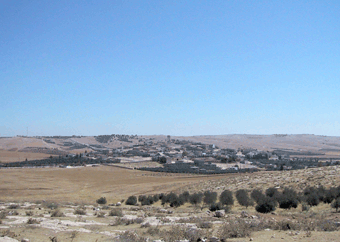 Libb is situated on a large oblong khirbat oriented on a southwest-northeast axis and located approximately 13 kilometers south of the modern town of Madaba. The population of the modern town is about 10,000. The site appears to be positioned atop two terraces. The Wadi Libb is located to the north and east of the site. Numerous cisterns are located within the site boundaries, which are used for the collection of water in winter, during the rainy season. A local resident informed the field crew that the water collected within the cisterns, along the lower portion of the site, is often used to saturate the crop fields located at the bottom of the slope. Surrounded by low sloping hills, the site sits in a fertile valley located on the southwest edge of the Madaba Plain, virtually in a bowl-shaped landform. At the time of the survey, olive trees, fig trees, tunas, and grapes were observed growing in the fields that surround the site. Fallow fields were used for grain crops. Large exposures of limestone bedrock are also present along the slope of the khirbat. The khirbat contains a combination of modern houses, which make up the villageof Libb, and archaeological ruins consisting of Ottoman houses and exposed wall lines. As a result of bulldozer activity and non-archaeological excavations within the site, deep cultural deposits have been exposed. A number of different time periods were represented by the pottery observed within these cuts. Libb sits along the modern route commonly known as the King’s Highway, and follows the Roman Via Nova Traiana, often believed to have been based on the older biblical King's Highway. Libb may have benefited greatly from the fertility of its surroundings, and it might have also been used as an entrepot located along these ancient trade and travel routes. Much of the site has been disturbed or completely destroyed due to modern construction. All of the Ottoman houses have suffered severe damage in one form or another, and many have been destroyed completely and are no longer visible on the surface.
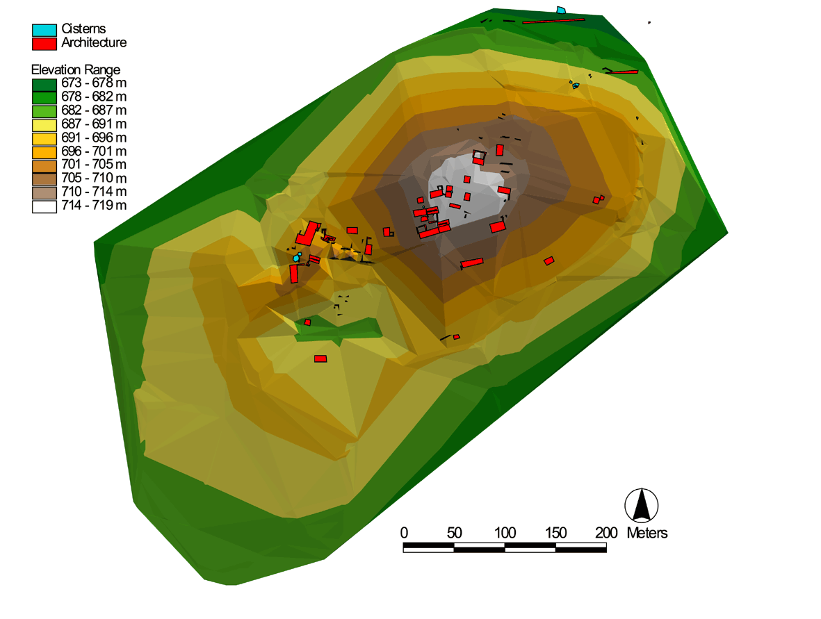 The 2000 surveying effort resulted in a detailed topographic map of Libb, with all identifiable premodern houses also included on the site plan. The surface survey resulted in the collection of 3,705 sherds from 49 survey squares. The sherds were washed, read, and registered in Madaba. The diagnostics were separated and will be shipped to Torontofor further study. The major periods represented in the current ceramic corpus from Libb are Iron Age, Roman, Byzantine, Umayyad and Mamluk. The sherd collection revealed approximately 131 Iron Age, 282 Roman-Byzantine, 105 Umayyad, and 391 Mamluk diagnostics. One possible Abbasid, and two Nabataean sherds were also identified. Ottoman period ceramics were also recognized. The volume of Mamluk pottery was extensive, and suggests the existence of a significant settlement at the site during this period. The 2000 survey was brief and isolated to only the upper segment of the site. However, it provided much needed information concerning the archaeological record preserved at Libb. A total of 22 Ottoman houses, 20 cisterns, 11 caves, and 74 wall lines were located and mapped. A total of 49 units were systematically inspected, and all visible cultural material was collected. The materials collected included pottery, lithic debris, and a variety of fragmentary basalt ground stone tools.
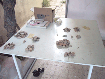 The survey of Libb indicates that the site likely was inhabited almost continually from the Iron Age to the present day. Wall lines located at the base of the north side of the site may have been part of a reservoir fed by the seasonal wadi. The surrounding fields were likely reserved for agricultural cultivation throughout the occupation of the site. Installations for the production of olive or wine were probably maintained in the exposed bedrock hills that surround Libb. Questions regarding the date and function of a series of "ring roads" that encircle the site were resolved during the 2001 survey season. On the southeast side of the site, a modern road has cut a clear cultural deposit over two meters in depth. This deposit continues under the road. A quantity of Iron Age sherds, including painted Moabite Ware, was collected from two squares located on the lower road cut. Therefore it is likely that these ring roads, once thought to have been ancient terraces reused as modern roads, are entirely of modern construction. Pottery collected in the 2001 season does not significantly differ from that of the previous season. The dominant periods identified so far from Libb remain the Iron Age, Roman-Byzantine, and Mamluk periods. While Iron Age and Roman-Byzantine sites are well known in the Madaba Plain, Mamluk settlements have not been as well documented. Excavations at Libb, therefore, with its extensive remains from this period, would add important information to the history of this poorly understood period. Given the extensive archaeological history documented by the survey at Libb, it is recommended that measures be taken to minimize the loss of this important archaeological record. The development of the summit of the site seriously threatens the archaeological remains preserved there. While such efforts likely would not take the form of full-scale excavations, due to the modern buildings and standing Ottoman houses, a series of test units, however, could recover important information about the archaeology of small settlements in the region, particularly during periods of limited sedentary activity. Consequently, it is recommended that limited scale excavations take place at Libb, especially before more of the site is irrevocably lost to modern development.
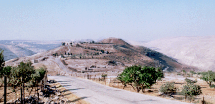 The site of Khirbet al-Mukhayyat (ancient Nebo) lies some 9 km northwest of Madaba, on the southeastern spur of the Nebo ridge. Situated on a steep limestone promontory, Mukhayyat commands an impressive view overlooking the Dead Sea and Jordan valley to the west. Most famous for its Byzantine mosaics and ecclesiastical architecture, Mukhayyat also boasts an extensive array of tombs, caves, cisterns, various agricultural installations and a well-preserved fortification system. Despite the abundance of this material, previous archaeological research at Mukhayyat has generally concentrated its efforts towards the examination and preservation of the Byzantine occupation at the site. While such research has been a significant contribution to the understanding of Byzantine culture in this region, the exclusion of earlier material has left a gap in our understanding of the occupational sequence at Mukhayyat. Modern exploration of the site began in 1863 with a brief visit by Félicien De Saulcy, who is generally credited with being the first to record the name, Khirbet al-Mukhayyat. In the summer of 1901, Alois Musil was the first to explore Mukhayyat systematically, identifying the Churches of Lot, Procopius, Amos and Kasiseus. In addition he also created the first topographic plan of the site. Nelson Glueck visited Mukhayyat in 1932, comparing the well-preserved fortifications with those of the al-Mashhad fortress near ‘Ain Musa and el-Medeiyineh to the south. He is also to be credited with the first identification of the rock cut towards the southern end of the site as a moat. Much of our current understanding of Mukhayyat comes from the efforts of the Studium Biblicum Franciscanum. Systematic explorations by the Franciscan’s began in 1933 with Brother Jerome Mihaic’s work uncovering the mosaics in the Chapel of the Priest John on the eastern slope of the tell, and in the Church of Saint George on the acropolis. In the 1960s an expedition led by J. Ripamonti conducted excavations at Rujm al-Mukhayyat, as well as a survey of the area that produced two Iron Age tombs, both of which were subsequently excavated by Saller in 1965. Work continued in the early 1970’s at Mukhayyat under the direction of Fr. Piccirillo. It was during this time that a comprehensive preservation and conservation program began that would involve all of the excavated mosaics and related architecture at the site. In the late 1980s and early 1990s this work continued with detailed excavations on the acropolis and surrounding area, resulting in the primary data that has afforded our current understanding of the occupational sequence at Mukhayyat.
 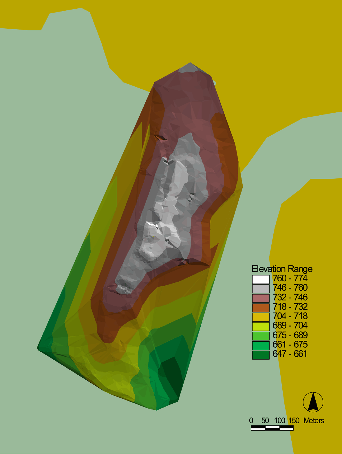 The 2001 survey follows on the topographic survey completed in 2000. The principal goal of the 2001 season was to randomly recover 20% of the extant surface remains (lithics, pottery, etc.) in order to produce a density and distribution profile of the occupational history of the site. A second objective was to continue observation and documentation of extant architectural remains at Mukhayyat, the purpose of which is to provide additional data in support the analysis of the cultural material collected.
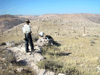 While no final conclusions can be made without more in-depth analysis, some preliminary observations of the cultural material recovered are possible. It is clear from the distribution of ceramics by period type that Mukhayyat shows a significant density of ceramics dating to the Byzantine and Iron Age periods across the entire survey universe. While the majority of pottery recovered is attributable to the Byzantine period (16,096 sherds), significant quantities of Iron Age ceramics (7,074) have been identified. While other periods were represented in the recovered material, their sherd counts demonstrated only ephemeral, sporadic occupation generally restricted towards the northern end of the site. It is expected that future analysis will incorporate the topographic information contained within the GIS alongside the recovered material culture in order to suggest more tightly defined occupational zones across the site during the Byzantine and Iron Age periods. More traditional ceramic analysis will be performed on the diagnostic material with the goal of inserting the recovered ceramics into the wider morphological sequence of the region. Finally, petrographic and chemical analysis on selected diagnostic material may provide additional information with regard to ceramic production technology, as well as points of contact between other sites within the region. Ultimately it is anticipated that the results of these analyses will support further fieldwork and excavation at Mukhayyat as part of a larger research effort to continue to fully document and discover the history and importance of one of Jordan's most spectacular cultural resources.
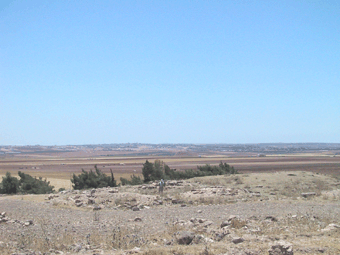 The site of Masuh is located approximately 10 km north of Madaba, 3 km east of Hesban by road. Masuh is also known in the archaeological literature (see the bibliography below) as: Masouh, Khurbet Masuh (or Hirbet Masuh), Massuh (or El-Massuh) and Tell Masuh. The site includes a necropolis (with olive presses and water facilities) to the southwest, two churches, a temple and numerous other architectural remains. The main area of the site lies on a hill rising to the north of the road from Hesban, and is characterized by a large number of crater-like pits, many of which have cisterns or subterranean arch-roofed structures at their bottoms. The length of occupation at Masuh extends from the Iron II or Persian period until the present day, although probably not continuously. C. R. Conder, who visited the site in 1881, wrote the earliest archaeological assessment of Masuh. Other archaeologists visited the site, but excavations did not begin until 1970, under Bastiaan Van Elderen, who studied a church (referred to by this study as the “East Church”) and its mosaics. In 1982, Fr. Michele Piccirillo began excavations at the same church, removing part of the upper mosaic floor (now in the Madaba Archaeological Park) and exposing the lower mosaic floor. R. D. Ibach also studied the site, as part of the Hesban Survey in 1973, collecting 315 sherds. This surface collection included Iron II/Persian, Late Roman, Byzantine, Umayyad, Ayyubid/Mamluk/Otttoman and modern sherds. In the summer of 2000, Hazem Jaser, Director of the Madaba office of the Department of Antiquities, excavated another church (here the "North Church"). Hazem Jaser kindly provided a copy of the plan of this church, as yet unpublished, for this study.
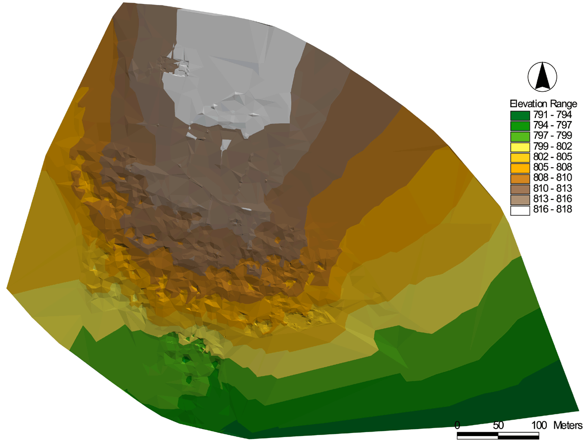 A total of 2,822 topographic points were taken in the settlement area of Masuh (i.e. excluding the necropolis), to the north of the modern road from Hesban. These were imported into ArcView GIS to produce an accurate topographic map of the site, over which digitized plans of the excavated churches were superimposed. A general surface collection of sherds and other objects was collected for further research. The total collection included 60 sherds, 2 lithics, 2 tesserae, as well as fragments of a steatite bowl, an Ottoman pipe, and a piece of glass. Of these, a study collection was assembled which includes all but 30 of the sherds and the tesserae, which were discarded. The items in the study collection will be studied and drawn at a later date, in order to complete a preliminary assessment of the occupational history of Masuh and compare these results with those of the Hesban Survey. Digital and print photographs were taken of some of the more important architectural remains and other features such as the inscriptions. These points also were geo-referenced with the total station. The resulting photographic archive will help to more fully document the site. Conclusions from the topographic and ceramic studies of Masuh will be used to determine what activities may be feasible in future research seasons. It is hoped that the site map produced by the 2001 Masuh topographic survey will help both to document the site, and serve as an aid for future researchers. The results of modern looting at the site for stone and artifacts was observed during the mapping process, and increases the need for enhanced cultural resource management at this important Late Antique and Mediaeval site.