Click below to see archival footage of excavations at Tell Madaba in 2006.
INTRODUCTION:
The Tall Mādabā Archaeological Project (TMAP) represents part of a broader, regional research effort that seeks to test prevailing theories about the development of centralized institutions and the rise of early state-ordered societies in the southern Levant. Drawing on the historical perspective that the archaeological record represents, this effort seeks to achieve the following research objectives:
Document the changing subsistence strategies of specific communities over time;
Identify the underlying social factors that may have influenced decision making processes;
Assess the impact adaptive responses have had on the fragile balance critical to maintaining ecological equilibrium--and long term viability--in a marginal, or transitional, environment.
Given the current concern in Jordan for developing, or re-introducing, economic strategies that conserve scarce cultural and natural resources, these research objectives address issues of contemporary relevance and importance. Within this broader research framework, the Tall Mādabā excavations were initiated for the specific purpose of gathering archaeological data from the presumed urban center of a regional settlement network for comparison with existing data sets from comparable contexts (e.g. domestic/residential, administrative/public, etc.) at contemporary rural village sites in the region. In the modern Middle East, with its long history of urbanism, the consequences of urban continuity present a daunting challenge to this type of archaeological research.
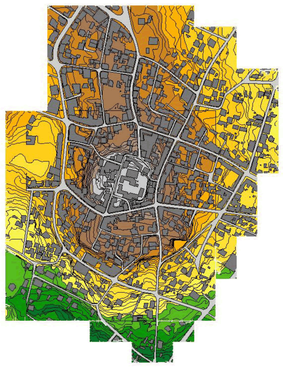
The city of Mādabā, located 30 km southwest of Amman amidst the fertile rolling plains of the Central Jordanian Plateau, represents an exceptional example of this phenomenon. Continuing an urban tradition of some 5,000 years, the modern town engulfs the ancient settlement, preserved in the form of a large low-lying tall and acropolis that still forms a visible rise in the town center. Clearly, Mādabā’s historical prominence necessitates a thorough assessment of its role in the long and eventful history of the Central Highlands of Jordan. The Tall Mādabā excavations were conceived with the goal of pursuing this investigation. By focusing on the central site of Mādabā, the project has been working since 1996 to anchor an emerging regional database, and to facilitate analysis of the changing economic and sociopolitical organization of communities on a regional level. For more detailed descriptions of the project’s research objectives and history, the reader is referred to previous reports submitted to the Department of Antiquities, and to published and forthcoming articles in the Annual of the Department of Antiquities of Jordan.
2006 FIELD SEASON OBJECTIVES:
In keeping with the Tall Mādabā Archaeological Project (TMAP) objective to map architecture and assemble quantifiable artifact assemblages for each of the principal phases of occupation at the site, the 2006 field season saw a continuation of the excavations begun in 1998 along the west acropolis (Fields B and C). The primary objectives of the 2006 TMAP field season, therefore, were:
To reopen two units in Field B in order to continue the effort to uncover the Iron Age levels first encountered in 1998;
To complete excavations of the monumental Late Byzantine/Early Islamic Complex in Field C.
In addition to excavation, time and resources were also devoted to improving the overall appearance of the site and assuring the protection of these remains after the field season. The 2006 season was conducted between June 5 and July 13, with the author acting as Project and Field Director, Andrew Graham overseeing the excavations in Field B in his capacity as Assistant Field Director, and Timothy Harrison continuing as overall Project Director. An archaeological field school for students from the University of Toronto was also run in conjunction with the 2006 field season.** Khaled Hawari and Abdullah al-Bawareed served as the Department of Antiquities representatives.
FIELD B EXCAVATIONS:
Excavations have been ongoing in Field B since 1998, and in that time deposits dating to the Late Ottoman (FP 1), Early Roman/Nabataean (FPs 2 and 3), Late Hellenistic (FPs 4 and 5), and Iron II (FP 6) periods have been exposed. As stated above, the primary goal of the 2006 season in Field B was to continue excavation of the Iron Age remains first encountered during the 1998 season. To this end, two units (Squares 5M21V3 and 5M21U4) on the northern edge of the previously excavated area, and to the east of the large fortification wall, were reopened (Figure 3).
FORTIFICATION WALL
The massive fortification wall that bisects Fields B and C, represents the most dominant Iron Age feature at Madaba. Previous excavation efforts (2002) were able to determine that the interior face of the wall was constructed as early as the Iron IIB period but this was only a terminus post quem as further excavation was required to assess a more precise construction date.
In order to answer the question of when the fortification was built, a sondage was cut against the wall in the NW quadrant of 5M21U4. This probe was instrumental in providing the stratigraphic sequence preceding the Iron IIB phase of occupation at Tell Madaba. Beginning with L.134 at 786.52m ASL, the sondage continued to expose cultural material spanning the Iron IIA and IIB periods. A significant decrease in distinctly “Moabite” ceramics (particularly the fine painted wares associated with the 9th and 8th C. BCE) as the probe descended eventually culminated in a hard, beaten-earth surface (L.149) at the 784.75m asl. level. There was no doubt that this surface (L.149) sealed against the fortification wall and was further characterized by flat-lying pottery and an in-situ vessel. Removal of this surface and continued excavation of the sondage revealed a series of deposits essentially devoid of cultural material. Eventually bedrock was reached at the 784.46m ASL.
Although the sondage was a relatively narrow probe into the earliest phases of the tell, the information yielded by this operation is invaluable for understanding the settlement process (as preserved in Field B) at Tell Madaba. It is clear from the absence of cultural material on the surface of bedrock that, while there is evidence of EB occupation at Madaba (Field A excavations), it has not been preserved in this part of the tell. The low frequency of EB pottery from the sondage would seem to eliminate the EB period for the initial construction date of the wall and place it firmly in the Iron I/Iron IIA period (FP8). While the 1m of sterile deposits below the surface of L.149 would seem to be sufficient to make this claim, only expanded horizontal exposure elsewhere on the tell will definitively secure this dating.
FIELD PHASE 6 (FP6)
As already discussed in our previous preliminary reports, FP6 represents a “squatter” phase after the destruction/abandonment of the Iron IIB (FP7) occupation of the tell. Much of the related surfaces, installations and architecture attributable to this phase (FP6) were removed at the beginning of the 2006 season to allow for greater horizontal exposure of the Iron IIB (FP7) settlement. In the process of removing these structures it became clear in both 5M21U4 and 5M21V3 that there were additional sub-phases of occupation attributable to FP6 that had previously gone undocumented.
At the end of the 2002 season it was determined that there were 4 occupational sub-phases associated with FP6, most of which were represented by various installations (tabuns, beaten earth surfaces, flat-lying pottery, etc.) excavated in 5M21U4 (see 2002 DOA report). The earliest of these sub-phases (6.3, 6.4) appear to be preserved in the excavation of surfaces within the structure defined in 5M21V3 and represented by loci 152, 153, 155 and 156. These hard-packed, beaten-earth surfaces clearly sealed against the bottom of FP6 wall L.76/93. The continuity of ceramic material throughout the FP6 phases excavated indicate a relatively short period of use, though further analysis is require to substantiate this claim.
FIELD PHASE 7 (FP7)
The Iron IIB settlement (FP7) at Tell Madaba is represented by a large pillared building that is oriented N-S about 1.5 meters in from the fortification wall. This building had two exterior walls represented by 5M21U4:112 and 5M21V3:118. A series of pillars (5M21V3:147,148 and 149) were clearly constructed equidistant to the exterior walls to provide support for either the roof or 2nd story of the building. Surfaces associated with this building are most clear in the sequence recovered from 5M21U4 and are evident in the southern baulk as L.164 at the 786.33m ASL level. This surface (L.164) represents the 1st occupational surface of the Iron IIB settlement corresponding to FP7.2. The end of the Iron IIB phase of occupation at Tell Madaba has been described as the result of a “destruction” (the nature of which is yet undetermined), however the complete excavation of the FP7 structures has yielded a surprisingly small amount of cultural material. Ceramic counts are conspicuously low and posit either abandonment or an aggressive reconstruction/reuse campaign by the FP6 “squatters”. A monolithic post (5M21V3:160) was discovered, partially situated in the southern baulk but in line with the central pillars of this building creating a “doorway” from the eastern side of the pillared building to the western side. Due to the restricted size of the excavation area it was difficult to trace the occupational surface (5M21U4:164) into this area, however based on construction phasing – it would seem likely. Some problems continue to exist in determining the phasing of this building, particularly in the NE quadrant of 5M21V3 where L.130 seems to abut the line of pillars (at L. 147). Based on the lack of surfaces sealing against L.130 its possible that the FP6 “squatters” cut into FP7 to install L.130 as a companion wall to L.76/93, however only the removal of L.130 will be definitive in this matter.
FIELD PHASE 8 (FP8)
One of the highlights of the 2006 season was the discovery of an earlier Iron Age occupation at Tell Madaba represented by the appearance of large walls lying directly under the FP7, Iron IIB pillared building (Figure 6). While only partially exposed in both 5M21U4 and 5M21V3, this structure was clearly more “monumental” than its later Iron IIB/FP7 counterpart – the preservation of which is due in part to the FP7 builders using these walls as foundation supports (particularly clear in the case of pillar 5M21V3:149 over 5M21U4:158). A restricted probe was conducted against two of these walls in 5M21U4 to determine the nature of this building which revealed a possible sub-phase represented by a hearth lying directly on-top of the primary surface (L.186) of the building. While no stratigraphic link can be made at this point it is important to note that the elevation of L.186 at 784.86m ASL corresponds well with the elevation of the beaten earth surface found in the NW sondage at the 784.75m ASL level. This correspondence continues when the ceramic evidence is examined. The surface of L.186 was littered with large pithoi that are reminiscent of Iron I/IIA collared-rim variants, however, no secure diagnostics were recovered.
CONCLUSIONS
Based on the results of the 2006 season we are able to make some tentative conclusions as to the nature of the Iron Age settlement of Madaba. It is clear that the construction of the interior face of the fortification wall was begun sometime in the Iron I/IIA period, predating the Iron IIB settlement. This observation makes it less likely that the wall, or at least the interior face of the wall which represents the last construction phase, is attributable to the building campaigns of Mesha as discussed in the Mesha Stele. The fact that little EB pottery was recovered from the sondage against the fortification wall in conjunction with the sterile construction fills below the Iron I/IIA surface makes it less likely that this wall was begun in the EB and simply added to in the Iron I/IIA period. A more reasonable hypothesis is that the construction phasing of the fortification wall is more representative of engineering constraints than chronological phasing. The fact that the wall was constructed during the Iron I/IIA period and has “monumental” architecture associated with it, pushes back our understanding of Madaba as an ephemeral Iron I/IIA settlement and makes it more likely that it was at this time that Madaba functioned as a large urban settlement dominating surrounding agricultural zone.
FIELD C EXCAVATIONS:
Previous seasons of excavation in Field C have uncovered the remains of a monumental building dating to the Late Byzantine/Early Islamic period. The primary objectives of the 2006 field season were to finish uncovering this structure, and thus perhaps clarify its exact nature. The 2006 excavations in Field C focused on two areas: (1) the western and southern extent of the bedrock ledge that forms the southwestern portion of the building; and (2) Room 6 – the area to the west of Room 5.
BEDROCK
Excavation efforts on the bedrock ledge in 2002 produced a surprising amount of architecture and cultural material. It had been assumed that earlier bulldozer activity in this area had destroyed and removed any ancient remains; however, several small retaining walls were uncovered and many interesting artifacts were recovered (see 2002 Field Report). Thus it was necessary to expand the excavation area this season in order to fully comprehend this portion of the building. Excavation on the bedrock consisted of two separate activities:
The removal of balks still remaining from the 2002 field season.
The opening of new excavation units to the west and south.
The removal of the northern balk of 5L22T3 exposed more of the bedrock ledge already present in this unit and 5L22T1. It is now clear that the upper bedrock ledge extends to the north and is cut with several small water channels. The eastern corner of the northern balk of 5L22S4 was also excavated. A small north-south wall (5L22S4:9) was exposed that probably connected with an east-west wall to the south previously excavated in 2002. The presence of this wall confirms the hypothesis that the Field C building extended as far as the western edge of the bedrock ledge. Finally, the southern balk of 5L22X4 was removed in order to expose more of the architecture already present in this unit. The southern portion of the north-south wall excavated in 2002 and an east-west wall (5L22X4:57) were uncovered. Excavation was undertaken in 5L22S2 in order to completely expose the northwestern section of the Field C building and expose the western extent of the bedrock. The bedrock in this area is stepped and several channels have been cut into it (see image above). These channels may have been used to conduct water into the large cistern at the base of the building. 5L22S2 produced a total of 9 coins. Although cleaning and further study is needed, the size of the coins indicates that they may be Nabatean. Square 5L22X3 was also excavated during the 2006 field season in an effort to expose the area of the building to the south of the large cut in the bedrock. A large threshold stone (5L22X3:7) was uncovered along the southern balk indicating the entrance into this part of the building. A small retaining wall (5L22X3:10) runs up to the eastern side of the threshold and there appears to be a stone step to the south. The bedrock in the southern half of this unit has been plastered further supporting the idea that the residents of this building altered the bedrock in order to lay the foundations of the structure. Excavations were also undertaken in squares 5L21C2 and 5L22W4. Partial excavation in 5L21C2 during the 1999 field season produced a badly preserved white mosaic floor on the upper bedrock ledge and two large Hellenistic storage jars under the ledge to the west. The likelihood of finding a cave in this area prompted the re-opening of the unit; however, excavation simply revealed a pronounced overhang in the bedrock. A circular bin (5L21C2:23) was uncovered directly beneath this overhang. Although the material cultural recovered from the bin is mixed, this installation closely resembles those excavated by Prof. Timothy Harrison in Field A in 1996. This association may indicate an Early Bronze occupation of this area of the site. Excavation was begun in 5L22W4 in order to further explore the bedrock overhang present in 5L21C2. A small wall running east-west (5L22W4:4) up to the western face of the bedrock ledge was initially exposed. A more substantial north-south wall (5L22W4:7) was then uncovered to the north. This second wall forms the western boundary of a large circular bin (5L22W4:16) carved into the bedrock. The walls of the bin slope inward and are inscribed with tooling marks. The exact function of this installation is as yet unclear. It may have been used for food storage or water collection. As in previous seasons, the excavation activities on the bedrock areas of Field C produced a significant amount of pottery containing important examples from the Early Roman/Nabatean, Late Byzantine/Early Islamic, and Ayyubid/Mamluke periods. In addition several notable artifacts were also recovered including a large collection of coins and a ceramic lamp with a Greek inscription. One common feature of the excavation of this area of Field C is the natural crevices present in the bedrock. The soil contained in these channels is consistently sterile, perhaps as a result of deliberate filling in order to employ these natural elements in the hydrological activities in the building. A number of deep, smoothly-cut holes have been found in the bedrock ledges in Field C. Initially these were interpreted as door post-holes associated with the Byzantine/Early Islamic building; however, upon further reflection, these installations appear to pre-date the construction of this structure and are in no way related to the 6th/7th century CE material. The exact function of these smoothly cut holes remains unknown.
ROOM 6
A small area to the west of Room 5 was left unexcavated in 2002. The area was given the single square designation 5L22O2.† The line of the 1980 bulldozer cut was noticeable before excavation in the southeastern portion of the area. The remains of a plastered wall associated with the Byzantine/Early Islamic building were also visible in the northern half of the eastern section. Excavation was undertaken in the area in order to expose more the of the Field C building and perhaps clarify the exact nature of this structure. The fill inside this room contained a number of large cut stones, including a roofing slab. This may denote the presence of arches running east-west through this room and supporting a second storey (as has been found in other parts of this building). Large pieces of pottery were found amongst the arch stones, but this concentration of ceramic material did not continue down to floor level. As in other parts of this building, the soil directly on the floor is almost devoid of cultural material, indicating perhaps that the inhabitants of the building emptied it out before abandoning it.
Excavation in 5L22O2 succeeded in exposing an unpaved room equipped with a large entrance and a hydrological installation. In the southeast corner of Room 6 a shallow curvilinear basin (5L22O2:13) was uncovered. It is carved directly from the bedrock, except along the southwestern edge where the rim of the basin has been constructed from stone and mortar. The majority of the rim is coated in plaster that is incised with chevron-like decorations (similar to that found at other Early Islamic sites such as Umm al-Walid, the Amman Citadel Palace, and Qasr Hallabat). The plaster then extends to seal against the southern side of the large doorway to the north. A water channel exposed during the 2000 field season connects to the southwestern corner of the basin. The floor in this area slopes downward indicating that this channel was used as a drain for the basin. It is unclear how water would have entered the basin. A wall located to the southeast contains a pipe that may have conducted water into this installation. The exact function of this basin is as yet unclear; further study is required to develop a more comprehensive hypothesis as to its nature and association with the rest of the building. As mentioned above, a large doorway (5L22O2:30, 37, 38) measuring over a meter in width was constructed to the north of this basin connecting Rooms 5 and 6. A step carved from the bedrock and located to the west of the threshold stone is coated in plaster. The lowest course of the door frame is also carved from bedrock. The stones forming the frame are well-cut and coated in plaster. They may have been used as springers for the arches that supported the ceiling of this room. To the east of the threshold is a small cobble-paved area that originally sealed against the mosaic floor in Room 5. A large lintel stone removed from this area of the building in 2001 was most likely associated with this doorway. The size of this entrance and the care that was taken in its construction may be an indication of the importance of Room 5. This doorway was probably added to the building during the Early Islamic period when other alterations were made to the Field C building (including the plaster niche in Room 5, the doorway into Room 2, and the vault in Room 1).
†Although most of the area is actually contained in square 5L22O4, it was decided that assigning a new square designation would make recording procedures simpler since 5L22O4 had been opened during the 2002 field season.
CONCLUSIONS
The excavations conducted in Field C during the 2006 field season have aided in delineating the extent to which the bedrock ledges were employed in the construction of this building. The inhabitants of this structure were very resourceful in their use of the natural environment present on this area of the site. The bedrock was used not only has the foundation for the building but was also carved out to construct steps, thresholds, and various installations. Our most recent efforts will also help in understanding the function of Room 5 and its associated installations. The architecture and material culture exposed this season confirm the importance of the Field C building within the sphere of Late Byzantine/ Early Islamic Madaba and are a further indication that the Madaba area continued to prosper well into the 8th century CE.
ACKNOWLEDGEMENTS:
The 2006 field season of the Tell Madaba Archaeological Project were conducted in collaboration with the Department of Antiquities of Jordan, which provided guidance and access to field equipment. The season’s results would not have been possible without the dedicated help of Dr. Fawwaz al-Khraysheh, Director General of the Department of Antiquities, and Mr. Ali al-Khayyat, Director of the Department of Antiquities Office in Madaba.
**In addition to the Project/Field Director and Assistant Field Director, the staff consisted of Miranda Angus, Sarah Jagelewski, Jennifer Lewis, Sarah Lynchehaun, and Jessica Self. The student participants were Sanadalia Genus, Michael Golloher, Laura Herman, Laurna Jones, Tegan Kenward, John Krissilas, Sebastian Laforce, Eugenia Lui, Iam MacLeod, Lisa Malcolm, Zandra Mallinson, Anthony Pugh, Paulo Raposo, Alyse Runyan, Ellie Sufrin-Disler, Tanit Thorne, Florence Ting, Micheline Welte, Callum Wiggins, Tory Woolcott, and Bryan Wyshnicki.
 Given the current concern in Jordan for developing, or re-introducing, economic strategies that conserve scarce cultural and natural resources, these research objectives address issues of contemporary relevance and importance. Within this broader research framework, the Tall Mādabā excavations were initiated for the specific purpose of gathering archaeological data from the presumed urban center of a regional settlement network for comparison with existing data sets from comparable contexts (e.g. domestic/residential, administrative/public, etc.) at contemporary rural village sites in the region. In the modern Middle East, with its long history of urbanism, the consequences of urban continuity present a daunting challenge to this type of archaeological research.
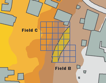 In keeping with the Tall Mādabā Archaeological Project (TMAP) objective to map architecture and assemble quantifiable artifact assemblages for each of the principal phases of occupation at the site, the 2006 field season saw a continuation of the excavations begun in 1998 along the west acropolis (Fields B and C). The primary objectives of the 2006 TMAP field season, therefore, were:
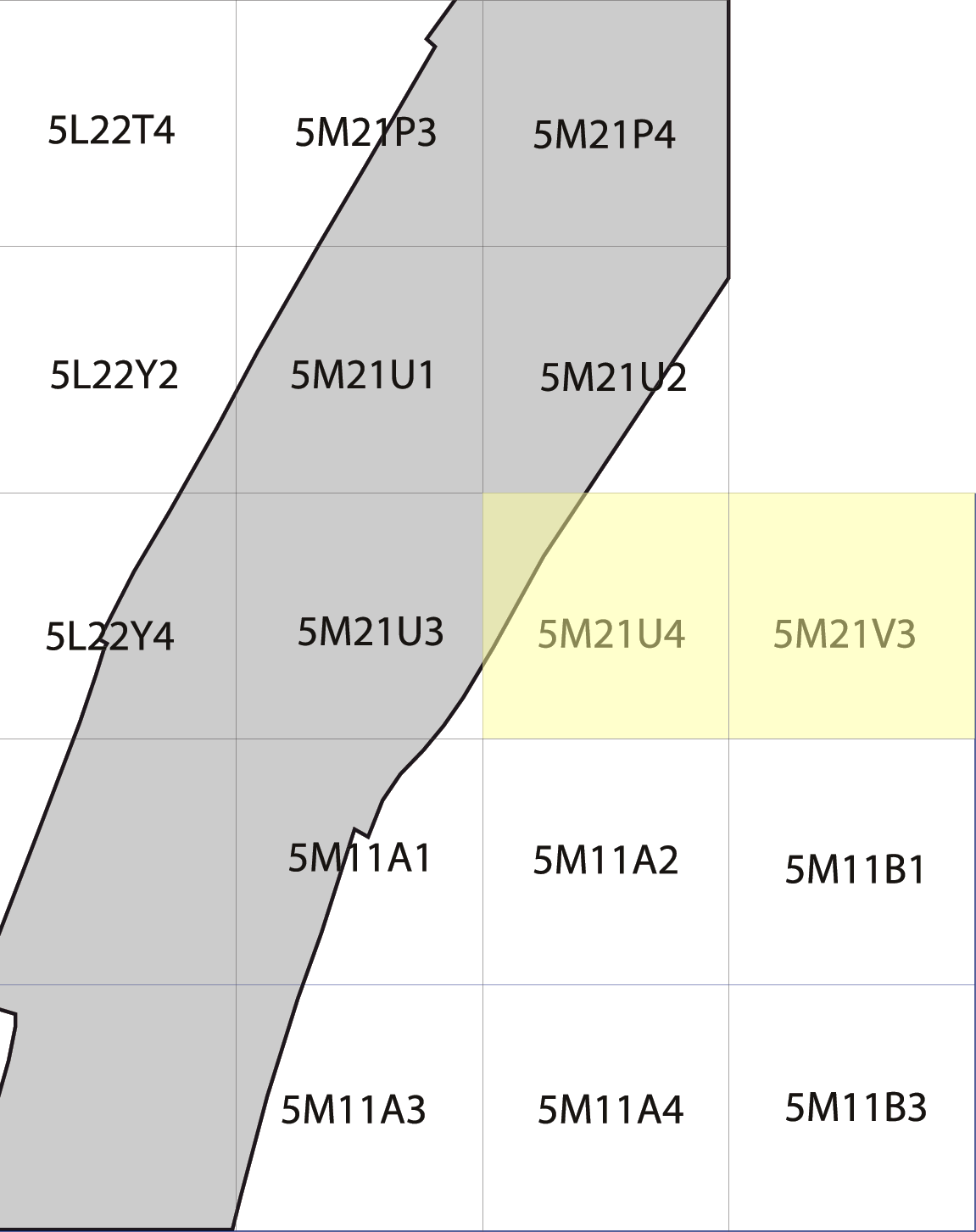 Excavations have been ongoing in Field B since 1998, and in that time deposits dating to the Late Ottoman (FP 1), Early Roman/Nabataean (FPs 2 and 3), Late Hellenistic (FPs 4 and 5), and Iron II (FP 6) periods have been exposed. As stated above, the primary goal of the 2006 season in Field B was to continue excavation of the Iron Age remains first encountered during the 1998 season. To this end, two units (Squares 5M21V3 and 5M21U4) on the northern edge of the previously excavated area, and to the east of the large fortification wall, were reopened (Figure 3).
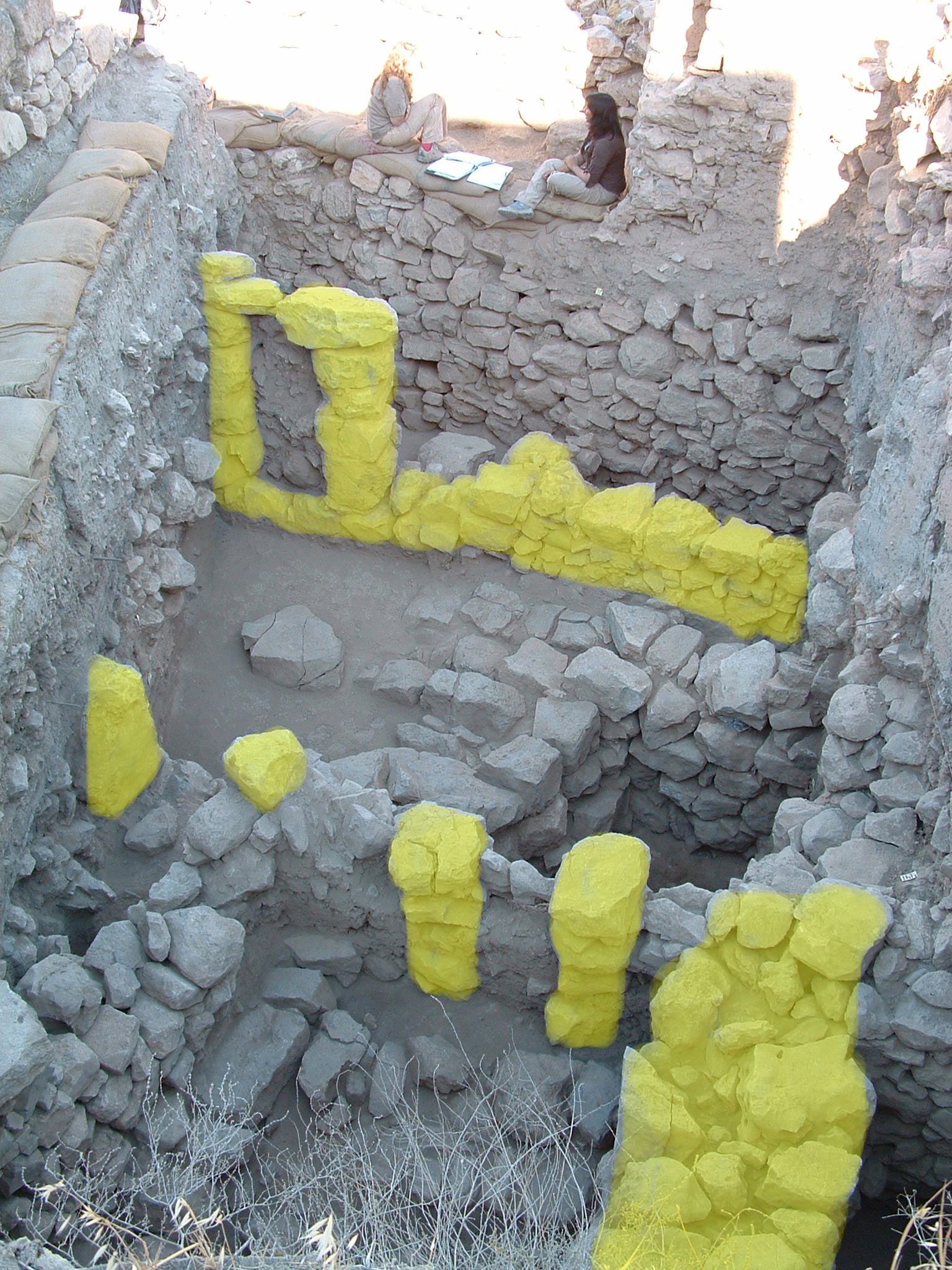 The Iron IIB settlement (FP7) at Tell Madaba is represented by a large pillared building that is oriented N-S about 1.5 meters in from the fortification wall. This building had two exterior walls represented by 5M21U4:112 and 5M21V3:118. A series of pillars (5M21V3:147,148 and 149) were clearly constructed equidistant to the exterior walls to provide support for either the roof or 2nd story of the building. Surfaces associated with this building are most clear in the sequence recovered from 5M21U4 and are evident in the southern baulk as L.164 at the 786.33m ASL level. This surface (L.164) represents the 1st occupational surface of the Iron IIB settlement corresponding to FP7.2. The end of the Iron IIB phase of occupation at Tell Madaba has been described as the result of a “destruction” (the nature of which is yet undetermined), however the complete excavation of the FP7 structures has yielded a surprisingly small amount of cultural material. Ceramic counts are conspicuously low and posit either abandonment or an aggressive reconstruction/reuse campaign by the FP6 “squatters”. A monolithic post (5M21V3:160) was discovered, partially situated in the southern baulk but in line with the central pillars of this building creating a “doorway” from the eastern side of the pillared building to the western side. Due to the restricted size of the excavation area it was difficult to trace the occupational surface (5M21U4:164) into this area, however based on construction phasing – it would seem likely. Some problems continue to exist in determining the phasing of this building, particularly in the NE quadrant of 5M21V3 where L.130 seems to abut the line of pillars (at L. 147). Based on the lack of surfaces sealing against L.130 its possible that the FP6 “squatters” cut into FP7 to install L.130 as a companion wall to L.76/93, however only the removal of L.130 will be definitive in this matter.
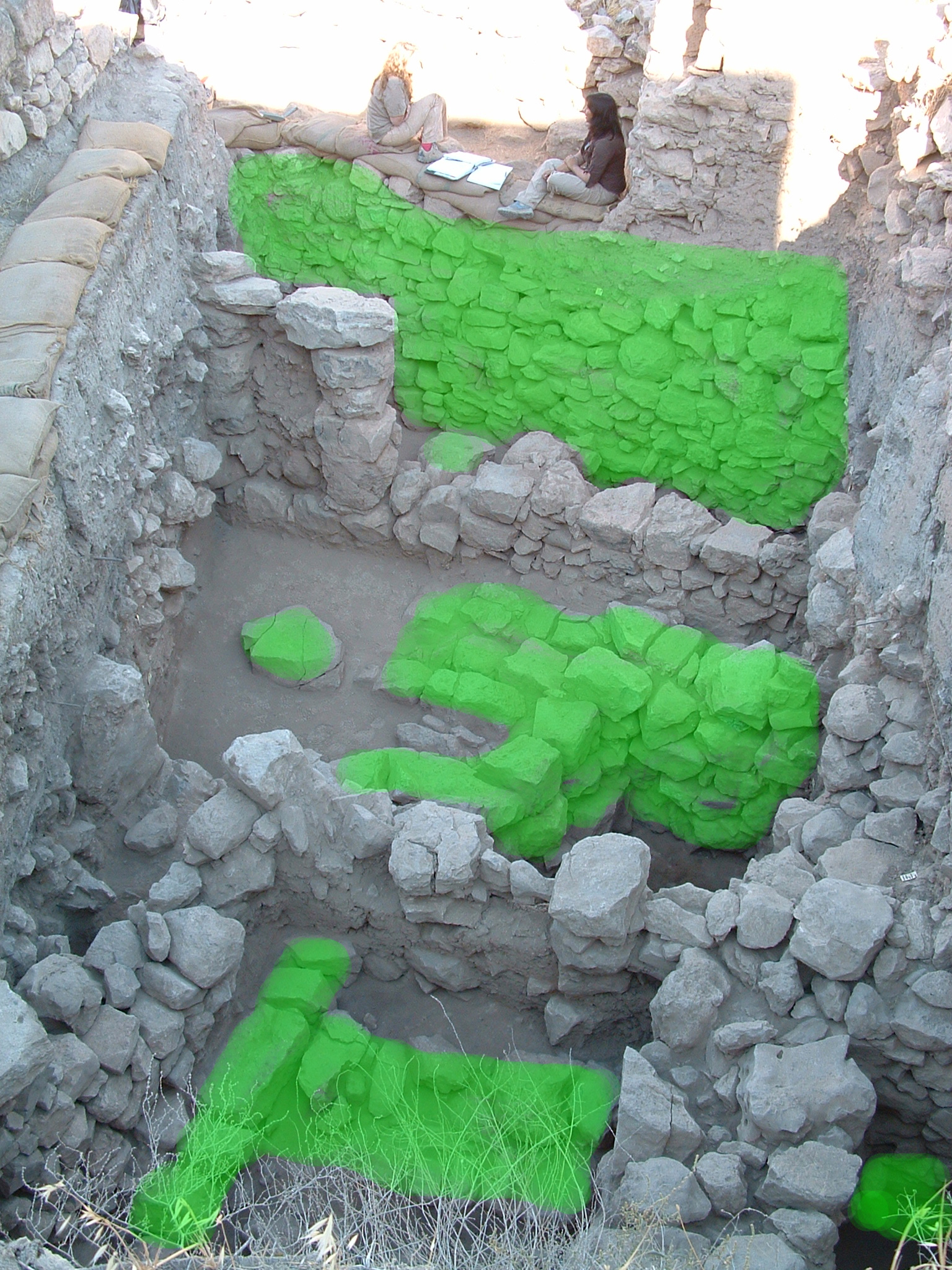 One of the highlights of the 2006 season was the discovery of an earlier Iron Age occupation at Tell Madaba represented by the appearance of large walls lying directly under the FP7, Iron IIB pillared building (Figure 6). While only partially exposed in both 5M21U4 and 5M21V3, this structure was clearly more “monumental” than its later Iron IIB/FP7 counterpart – the preservation of which is due in part to the FP7 builders using these walls as foundation supports (particularly clear in the case of pillar 5M21V3:149 over 5M21U4:158). A restricted probe was conducted against two of these walls in 5M21U4 to determine the nature of this building which revealed a possible sub-phase represented by a hearth lying directly on-top of the primary surface (L.186) of the building. While no stratigraphic link can be made at this point it is important to note that the elevation of L.186 at 784.86m ASL corresponds well with the elevation of the beaten earth surface found in the NW sondage at the 784.75m ASL level. This correspondence continues when the ceramic evidence is examined. The surface of L.186 was littered with large pithoi that are reminiscent of Iron I/IIA collared-rim variants, however, no secure diagnostics were recovered.
 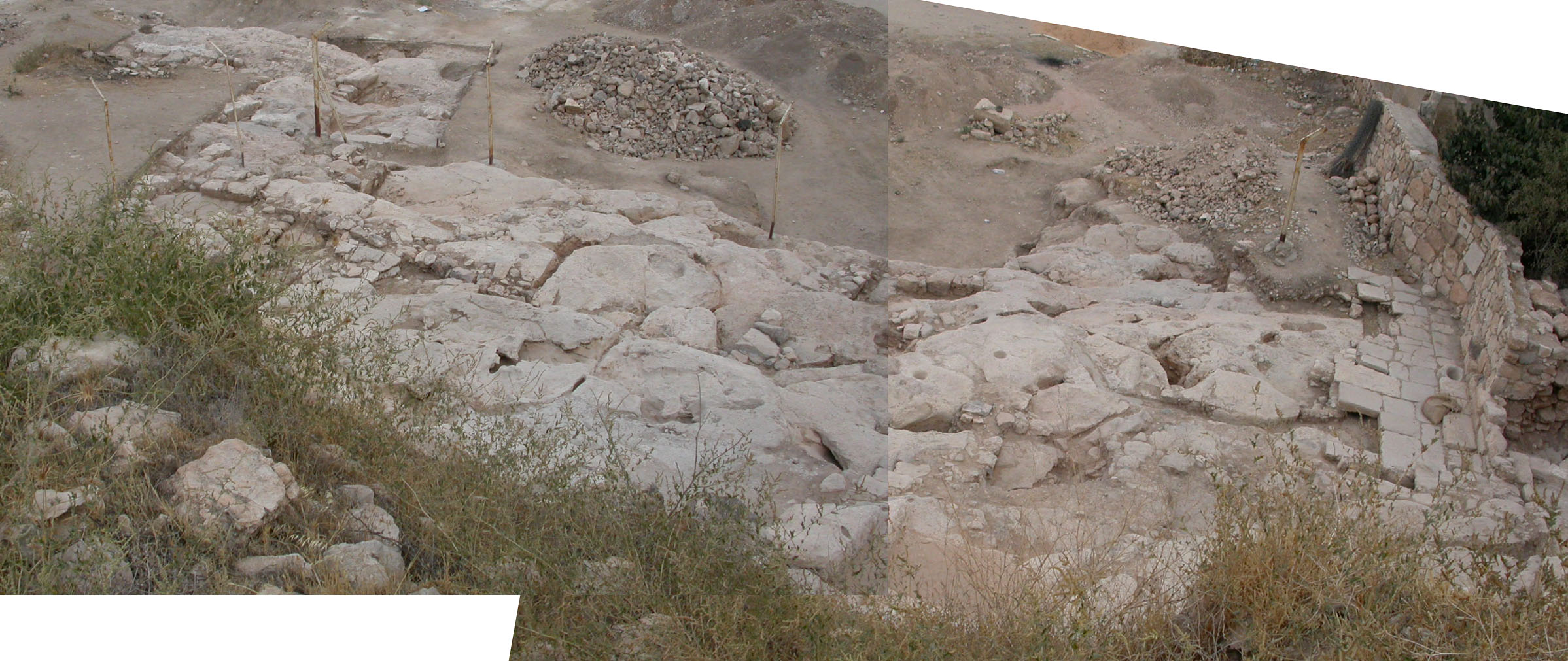 The removal of the northern balk of 5L22T3 exposed more of the bedrock ledge already present in this unit and 5L22T1. It is now clear that the upper bedrock ledge extends to the north and is cut with several small water channels. The eastern corner of the northern balk of 5L22S4 was also excavated. A small north-south wall (5L22S4:9) was exposed that probably connected with an east-west wall to the south previously excavated in 2002. The presence of this wall confirms the hypothesis that the Field C building extended as far as the western edge of the bedrock ledge. Finally, the southern balk of 5L22X4 was removed in order to expose more of the architecture already present in this unit. The southern portion of the north-south wall excavated in 2002 and an east-west wall (5L22X4:57) were uncovered. Excavation was undertaken in 5L22S2 in order to completely expose the northwestern section of the Field C building and expose the western extent of the bedrock. The bedrock in this area is stepped and several channels have been cut into it (see image above). These channels may have been used to conduct water into the large cistern at the base of the building. 5L22S2 produced a total of 9 coins. Although cleaning and further study is needed, the size of the coins indicates that they may be Nabatean. Square 5L22X3 was also excavated during the 2006 field season in an effort to expose the area of the building to the south of the large cut in the bedrock. A large threshold stone (5L22X3:7) was uncovered along the southern balk indicating the entrance into this part of the building. A small retaining wall (5L22X3:10) runs up to the eastern side of the threshold and there appears to be a stone step to the south. The bedrock in the southern half of this unit has been plastered further supporting the idea that the residents of this building altered the bedrock in order to lay the foundations of the structure. Excavations were also undertaken in squares 5L21C2 and 5L22W4. Partial excavation in 5L21C2 during the 1999 field season produced a badly preserved white mosaic floor on the upper bedrock ledge and two large Hellenistic storage jars under the ledge to the west. The likelihood of finding a cave in this area prompted the re-opening of the unit; however, excavation simply revealed a pronounced overhang in the bedrock. A circular bin (5L21C2:23) was uncovered directly beneath this overhang. Although the material cultural recovered from the bin is mixed, this installation closely resembles those excavated by Prof. Timothy Harrison in Field A in 1996. This association may indicate an Early Bronze occupation of this area of the site. Excavation was begun in 5L22W4 in order to further explore the bedrock overhang present in 5L21C2. A small wall running east-west (5L22W4:4) up to the western face of the bedrock ledge was initially exposed. A more substantial north-south wall (5L22W4:7) was then uncovered to the north. This second wall forms the western boundary of a large circular bin (5L22W4:16) carved into the bedrock. The walls of the bin slope inward and are inscribed with tooling marks. The exact function of this installation is as yet unclear. It may have been used for food storage or water collection. As in previous seasons, the excavation activities on the bedrock areas of Field C produced a significant amount of pottery containing important examples from the Early Roman/Nabatean, Late Byzantine/Early Islamic, and Ayyubid/Mamluke periods. In addition several notable artifacts were also recovered including a large collection of coins and a ceramic lamp with a Greek inscription. One common feature of the excavation of this area of Field C is the natural crevices present in the bedrock. The soil contained in these channels is consistently sterile, perhaps as a result of deliberate filling in order to employ these natural elements in the hydrological activities in the building. A number of deep, smoothly-cut holes have been found in the bedrock ledges in Field C. Initially these were interpreted as door post-holes associated with the Byzantine/Early Islamic building; however, upon further reflection, these installations appear to pre-date the construction of this structure and are in no way related to the 6th/7th century CE material. The exact function of these smoothly cut holes remains unknown.
 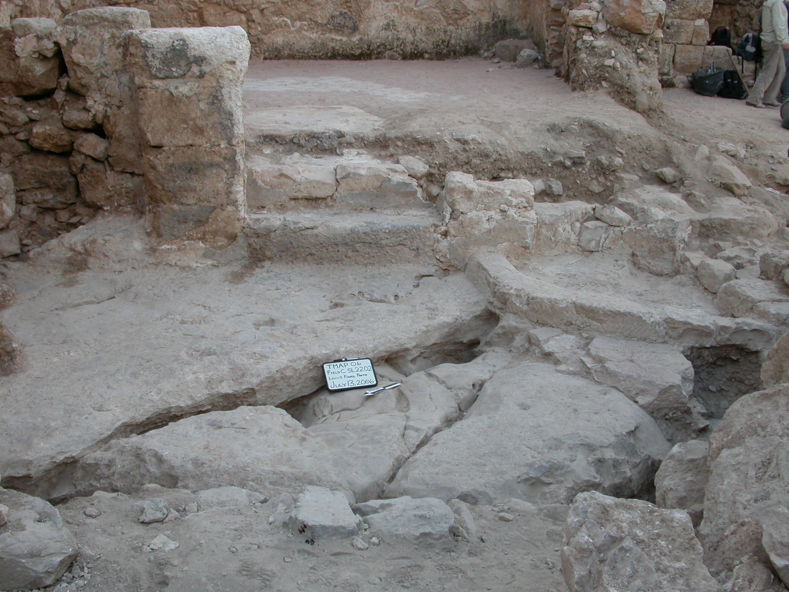 A small area to the west of Room 5 was left unexcavated in 2002. The area was given the single square designation 5L22O2.